
Hello guys today i wanna talk about the maps of Piri Reis, an turkish admiral lived in 16th century. Is the creator of a map, called "The world Map" a complex trama of maps discovered in the 1929 in Istanbul library. And becomes famous for a particularity, he represent different profile of unknown land not discovered at his time.
...It is told of an infidel named Columbus, of Genoa, who has discovered these traces. Piri Reis...
So let's talking about it and listen this music for create the atmosphere

E.S. Posthumus
Album : Cartographer (DISC 2 - Piri Reis Remixes)
Track 04 - "Mosane Pi"
YouTube standard license
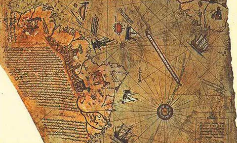
Photo from: Link
The australis land
In the meridional part was terrorized the existence of a continent, just for get in balance the distribution of the world. in fact in the ancient period, It was believed that the earth was round and for this motivation the necessity to figure out the possibility of the australis land. Difference century after, Tolomeus try to draw different map and describes inside that is australis land and describes in mythical way.
In the middle ages this theory was considered erethical, and this theory going in the darkness. But after the great exploration period the people returning at the original idea of the circle earth and the reborn of the myth of this australis land.
This tema was took also across the fantastic literature, in fact Edgar Allan Poe write the story of Gordon Pim a sailor Land on this sprawling southern land.
Also Lovecraft encompasses one of his novels, "The Mountains of Madness" right in Antarctica.
Piri Reis
But why the admiral Siri Reis know lands who the people don't know until this time? This map leaves us astonished. In fact, since the Antarctic mapping is known and represented in pre-glacial times as you could have this information at Columbus time? A hypothesis, even a science fiction, says that an anti-Leuvian people had left us a mapping of the earth as they knew it, and ended up in Piri Reis's hands. The map also represents many rivers of South America. In absolute precision. So someone in 1513 had also identified the islands of South America. Even so, many islands do not exist anymore.
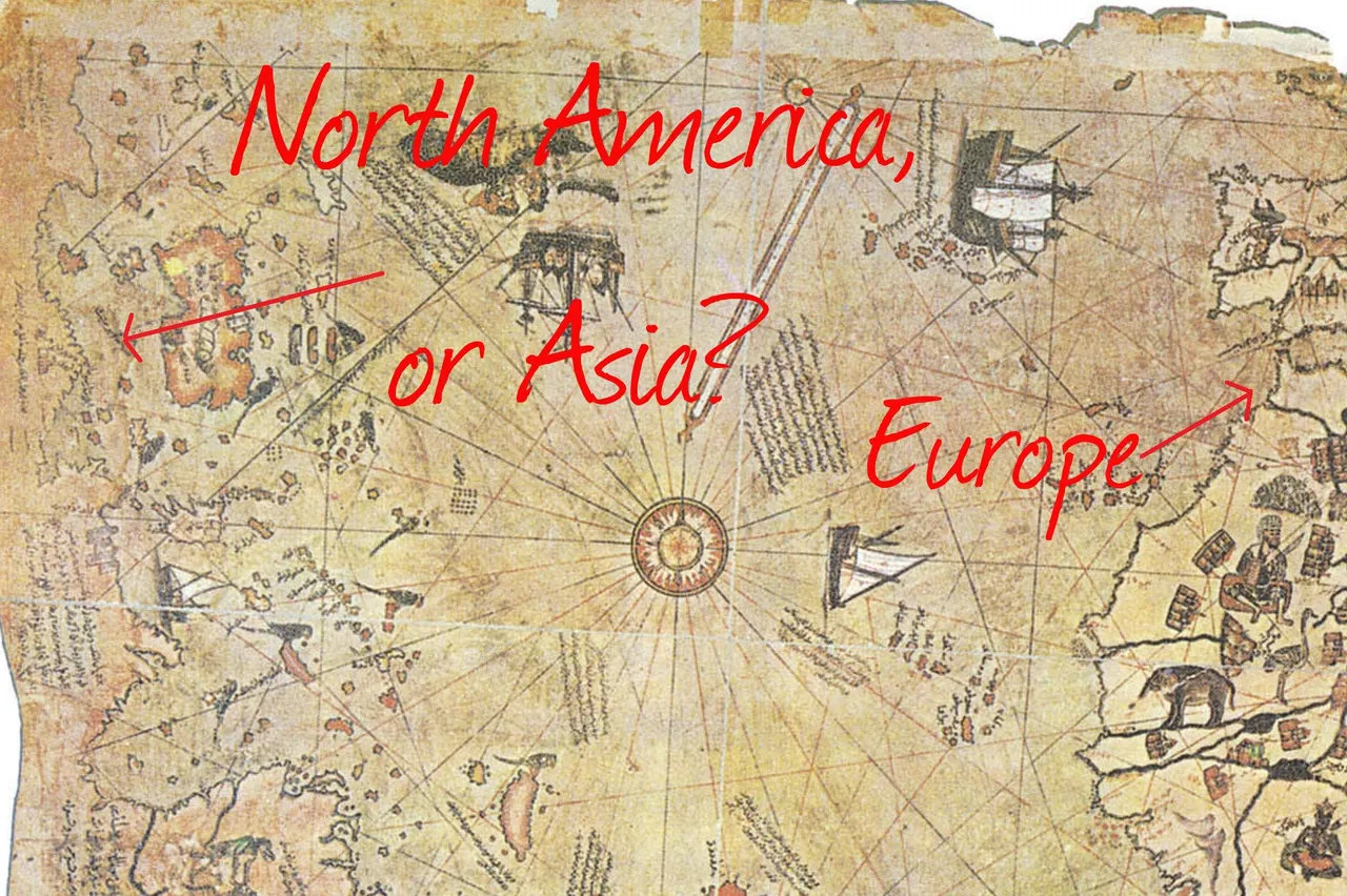
Photo from:Link
And you, have already know this map, please leave a comment in the comment section below, fell free to up vote and have a good day